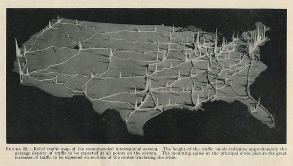
Eric Fischer found this relief map depicting the predicted traffic volumes of the “National System of Interregional Highways”, later known as the Interstate system. Another way of looking at this might have been, where should we build new train lines in addition to the Interstates? Sadly, that wasn’t the case.
Thanks to the support of readers like you, Per Square Mile remains independent and ad-free.
If you enjoy what you read, please consider supporting the site with a donation.
